

Preview
Document Type
StillImage
Contributing Institution
Maine State Archives
Identifier
298409
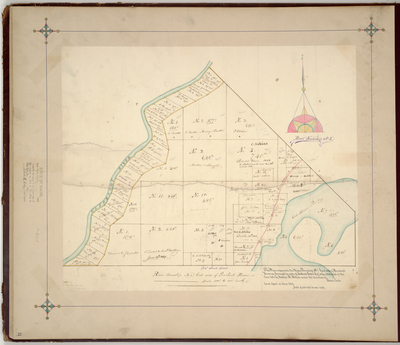
Description
Survey of T1, east side of Penobscot River, (now Enfield) on a scale of 100 rods to one inch. Shows border with General Joseph Treat's land.
Exact Creation Date
6-1824
Language
English
Location
Penobscot County; Enfield
Other Location
Penobscot River
Keywords
Cartography; Maps; Maine Land Office; Planbooks; Surveys