

Preview
Document Type
StillImage
Contributing Institution
Maine State Archives
Identifier
208257
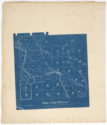
Description
Blueprint plan of T2 R1 WBKP on a scale of 30 chains to 1 inch.
Exact Creation Date
5-1897
Language
English
Location
Franklin County; Sandy River Plt
Other Location
Sandy River; Rangeley Lake; Long Pond; Saddleback Stream
Keywords
Cartography; Maps; Maine Land Office; Planbooks; Surveys
Image Location
Rights Statement
No Copyright - United States. URI: http://rightsstatements.org/vocab/NoC-US/1.0/
The organization that has made the Item available believes that the Item is in the Public Domain under the laws of the United States, but a determination was not made as to its copyright status under the copyright laws of other countries. The Item may not be in the Public Domain under the laws of other countries. Please refer to the organization that has made the Item available for more information.