

Preview
Document Type
StillImage
Contributing Institution
Maine State Archives
Identifier
208234
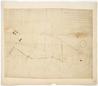
Description
Plan of land on the southeast side of Penobscot River from Bucks Town to the Indian Grant or flowing of the tide surveyed for Government by the subscribers in July 1784.
Exact Creation Date
7-1784
Language
English
Location
Hancock County; Bucksport
Keywords
Cartography; Maps; Maine Land Office; Planbooks; Surveys
Image Location
Rights Statement
No Copyright - United States. URI: http://rightsstatements.org/vocab/NoC-US/1.0/
The organization that has made the Item available believes that the Item is in the Public Domain under the laws of the United States, but a determination was not made as to its copyright status under the copyright laws of other countries. The Item may not be in the Public Domain under the laws of other countries. Please refer to the organization that has made the Item available for more information.