

Preview
Document Type
StillImage
Contributing Institution
Maine State Archives
Identifier
208227
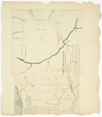
Description
Plan of T1 on the west Side of the Penobscot River, reserved for Penobscot Indians agreeable to treaty of the 30th June 1818
Plan of a tract of land granted to Thomas Johnson and others containing 8,103 acres as surveyed the 30th October 1818
Exact Creation Date
1818
Language
English
Location
Penobscot County; Old Town
Other Location
Penobscot River; Sunkhaze Stream; Orson Island; Pushaw Pond; Mattawamkeag River
Keywords
Cartography; Maps; Maine Land Office; Planbooks; Surveys
Image Location
Rights Statement
No Copyright - United States. URI: http://rightsstatements.org/vocab/NoC-US/1.0/
The organization that has made the Item available believes that the Item is in the Public Domain under the laws of the United States, but a determination was not made as to its copyright status under the copyright laws of other countries. The Item may not be in the Public Domain under the laws of other countries. Please refer to the organization that has made the Item available for more information.