

Preview
Document Type
StillImage
Contributing Institution
Maine State Archives
Identifier
302965
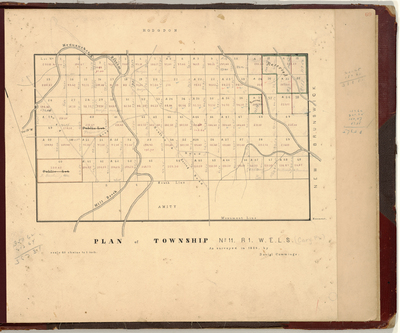
Description
Survey of T11 R1 WELS (Cary Plantation) on a scale of 40 chains to one inch.
Exact Creation Date
1856
Language
English
Location
Aroostook County; Cary Plt; Amity; Hodgdon
Other Location
Monument Line; Mill Brook; Houlton and Baring Road; Meduxnekeag Stream; New Brunswick
Keywords
Cartography; Maps; Maine Land Office; Planbooks; Surveys