

Preview
Document Type
StillImage
Contributing Institution
Maine State Archives
Identifier
302965
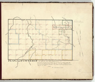
Description
Survey of T11 R1 (now Cary Plantation) on a scale of 40 chains to the inch.
Broad Creation Date
1824-1831
Language
English
Location
Aroostook County; Cary Plt
Other Location
Bulls Stream; Meduxnekeag Stream
Keywords
Cartography; Maps; Maine Land Office; Planbooks; Surveys