

Preview
Document Type
StillImage
Contributing Institution
Maine State Archives
Identifier
29451
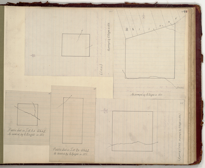
Description
Survey of public lots in Aroostook County: T18 R5 WELS, T18 R4 WELS, T18 R7 WELS, T17 R9 WELS, and T17 R8 WELS. Includes Fort Kent, Frenchville, Madawaska, St. Francis, and St. John.
Exact Creation Date
1870
Language
English
Location
Aroostook County; Frenchville; Fort Kent; Madawaska; Saint Francis; Saint John Plt
Keywords
Cartography; Maps; Maine Land Office; Planbooks; Surveys