

Preview
Document Type
StillImage
Contributing Institution
Maine State Archives
Identifier
29451
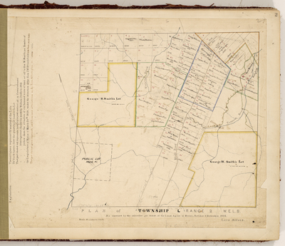
Description
Survey of TL R2 WELS on a scale of 40 chains to an inch, now known as Cyr Plantation.
Exact Creation Date
1858
Language
English
Location
Aroostook County; Cyr Plt
Other Location
Toussant Brook; Violette Brook
Keywords
Cartography; Maps; Maine Land Office; Planbooks; Surveys