

Preview
Document Type
StillImage
Contributing Institution
Maine State Archives
Identifier
29451
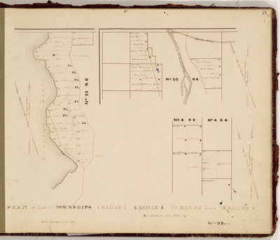
Description
Survey of T4 R4, T4 R5, T10 R5, and T13 R6 on a scale of 40 chains to one inch. These townships are now Crystal, Island Falls, Masardis, and Portage Lake.
Exact Creation Date
1861
Language
English
Location
Aroostook County; Crystal; Island Falls; Masardis; Portage Lake
Other Location
Portage Lake; Aroostook River; Scopan Stream
Keywords
Cartography; Maps; Maine Land Office; Planbooks; Surveys