

Preview
Document Type
StillImage
Contributing Institution
Maine State Archives
Identifier
210848
Description
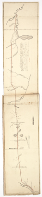
Plan represents the survey of a road from the mouth of the Mattawamkeag Stream, on the Penobscot, to the mouth of Fish River, on the St. John River, made in the summer of 1826.
Exact Creation Date
1826
Language
English
Location
Aroostook County; Penobscot County
Keywords
Cartography; Maps; Maine Land Office; Planbooks; Surveys