

Preview
Document Type
StillImage
Contributing Institution
Maine State Archives
Identifier
211800
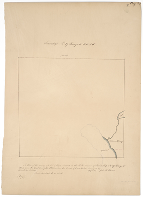
Description
Plan of the survey of a lot of land situated in the southeast corner of Township 17 Range 5 West from the East line of the State, and on the East side of Cross Lake on a scale of 40 chains to an inch.
Exact Creation Date
12-1-1848
Language
English
Location
Aroostook County
Other Location
Cross Lake
Keywords
Cartography; Maps; Maine Land Office; Planbooks; Surveys