

Preview
Document Type
StillImage
Contributing Institution
Maine State Archives
Identifier
212110
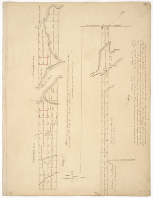
Description
Survey of T1 R1 and T2 R1 NBPP on a scale of 40 chains to an inch.
Survey of a gore of land between Raymond and Thompson Point Plantation now annexed to New Gloucster and Poland belonging to Massachusetts and Maine
Exact Creation Date
1832
Language
English
Location
Somerset County; Taunton and Raynham Academy Grant
Keywords
Cartography; Maps; Maine Land Office; Planbooks; Surveys
Image Location
Rights Statement
No Copyright - United States. URI: http://rightsstatements.org/vocab/NoC-US/1.0/
The organization that has made the Item available believes that the Item is in the Public Domain under the laws of the United States, but a determination was not made as to its copyright status under the copyright laws of other countries. The Item may not be in the Public Domain under the laws of other countries. Please refer to the organization that has made the Item available for more information.