

Preview
Document Type
StillImage
Contributing Institution
Maine State Archives
Identifier
211064
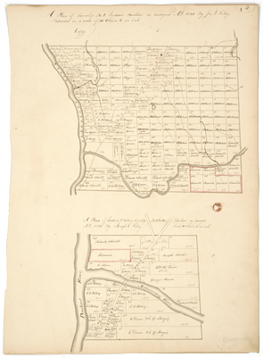
Description
Copy of a survey of T1 IP on a scale of 40 chains to an inch. Includes the Military Road, and a plan of Section 133 in T1 IP on a scale of 10 chains to an inch.
Exact Creation Date
1834
Language
English
Location
Penobscot County; Mattawamkeag
Other Location
Mattawamkeag River; Penobscot River
Keywords
Cartography; Maps; Maine Land Office; Planbooks; Surveys
Image Location
Rights Statement
No Copyright - United States. URI: http://rightsstatements.org/vocab/NoC-US/1.0/
The organization that has made the Item available believes that the Item is in the Public Domain under the laws of the United States, but a determination was not made as to its copyright status under the copyright laws of other countries. The Item may not be in the Public Domain under the laws of other countries. Please refer to the organization that has made the Item available for more information.