

Preview
Document Type
StillImage
Contributing Institution
Maine State Archives
Identifier
211064
Description
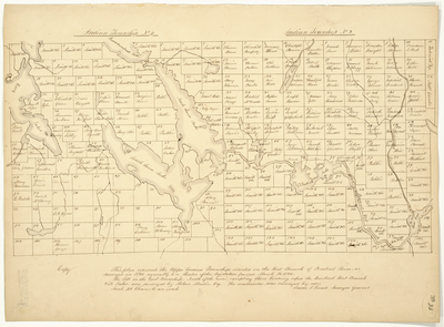
"This plan represents the Upper Indian Townships situated on the West Branch of Penobscot River, as surveyed in 1836 agreeably to a Resolve of the Legislature passed March 16, 1836.
The Lots in the East Township, North of the river, excepting those bordering upon the Penobscot West Branch and its Lakes, were surveyed by Asher Martin Esq. The remainder was surveyed by me, Isaac S. Small, Surveyor."
Scale 40 chains to an inch.
Exact Creation Date
1836
Language
English
Location
Penobscot County; T3 Indian Purchase Twp; T4 Indian Purchase Twp
Other Location
Twin Lake; Quakish Lake; Penobscot River; Millinocket Stream; Shad Pond
Keywords
Cartography; Maps; Maine Land Office; Planbooks; Surveys