

Preview
Contributing Institution
Maine State Archives
Document Type
StillImage
Identifier
208424
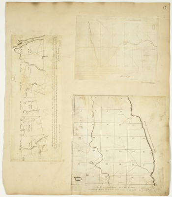
Description
Plan of T4 R13, 1835
Plan of half Township Letter E R2 WELS, 1855
Plan of T4 R13-18 WELS on a scale of 160 chains to an inch,1833
Language
English
Location
Piscataquis County; T4 R13 WELS; T4 R14 WELS; T4 R15 WELS; Aroostook County; E Twp
Other Location
Chesuncook Lake; Penobscot River; Nulhodus Stream; Russell Stream; Luther Stream; Pine Stream; Presque Isle Stream; Aroostook River; St. John River
Keywords
Cartography; Maps; Maine Land Office; Planbooks; Surveys
Rights Statement
No Copyright - United States. URI: http://rightsstatements.org/vocab/NoC-US/1.0/
The organization that has made the Item available believes that the Item is in the Public Domain under the laws of the United States, but a determination was not made as to its copyright status under the copyright laws of other countries. The Item may not be in the Public Domain under the laws of other countries. Please refer to the organization that has made the Item available for more information.