


Files
Download Map (2.6 MB)
Document Type
StillImage
Description
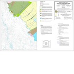
Maine Geological Survey, Progress Map 12-30.
Publication Code
12-30
Publication Date
1-1-2012
Publisher
Maine Geological Survey
Location
York County
Map Type
Bedrock Geology Maps (scale 1:24,000)
Map Scale
1:24000
Recommended Citation
Thompson, Peter J., Bothner, Wallace A., and Hussey, Arthur M., II, 2012, Bedrock geology of the Rochester quadrangle, Maine: Maine Geological Survey, Progress Map 12-30, color map, scale 1:24,000. Maine Geological Survey Maps. 65. http://digitalmaine.com/mgs_maps/65
Rights Statement

No Copyright - United States. URI: http://rightsstatements.org/vocab/NoC-US/1.0/
The organization that has made the Item available believes that the Item is in the Public Domain under the laws of the United States, but a determination was not made as to its copyright status under the copyright laws of other countries. The Item may not be in the Public Domain under the laws of other countries. Please refer to the organization that has made the Item available for more information.