


Files
Download Map (10.5 MB)
Document Type
StillImage
Description
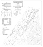
Maine Geological Survey, Open-File Map 91-8. Quadrangles covered: Allagash, Beaver Pond, Beau Lake, Depot Lake, Little East Lake, Rocky Brook, Rocky Mountain, Seven Islands
Publication Code
91-8
Publication Date
1-1-1991
Publisher
Maine Geological Survey
Supercedes
80-14B, 82-27
Location
Aroostook County
Map Type
Bedrock Geology Maps (scale 1:62,500)
Map Scale
1:62500
Recommended Citation
Roy, David C., Pollock, Stephen G. and Hanson, Lindley S., 1991, Bedrock geology of the upper St. John River area, northwestern Maine: Maine Geological Survey, Open-File Map 91-8, 2 maps, scale 1:62,500. Maine Geological Survey Maps. 210. http://digitalmaine.com/mgs_maps/210
Rights Statement

No Copyright - United States. URI: http://rightsstatements.org/vocab/NoC-US/1.0/
The organization that has made the Item available believes that the Item is in the Public Domain under the laws of the United States, but a determination was not made as to its copyright status under the copyright laws of other countries. The Item may not be in the Public Domain under the laws of other countries. Please refer to the organization that has made the Item available for more information.