


Files
Download Map (3.3 MB)
Document Type
StillImage
Description
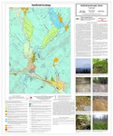
Maine Geological Survey, Open-File Map 18-2 (Superseded by Spigel, 2020, Maine Geological Survey Open-File 20-20).
Publication Code
18-2
Publication Date
3-16-2018
Publisher
Maine Geological Survey
Superceded by
Location
Franklin County; Oxford County
Map Type
Surficial Geology Maps (scale 1:24,000)
Map Scale
1:24000
Recommended Citation
Spigel, Lindsay J., 2018, Surficial geology of the Dixfield quadrangle, Maine: Maine Geological Survey, Open-File Map 18-2 (Superseded by Spigel, 2020, Maine Geological Survey Open-File 20-20), map, scale 1:24,000. Maine Geological Survey Maps. 2063. https://digitalmaine.com/mgs_maps/2063
Rights Statement

No Copyright - United States. URI: http://rightsstatements.org/vocab/NoC-US/1.0/
The organization that has made the Item available believes that the Item is in the Public Domain under the laws of the United States, but a determination was not made as to its copyright status under the copyright laws of other countries. The Item may not be in the Public Domain under the laws of other countries. Please refer to the organization that has made the Item available for more information.