


Files
Download Map (6.6 MB)
Document Type
StillImage
Description
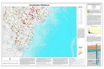
Maine Geological Survey, Open-File Map 10-47.
Publication Code
10-47
Publication Date
1-1-2010
Publisher
Maine Geological Survey
Supercedes
07-87
Location
Cumberland County; York County
Map Type
Bedrock Groundwater Resources Basic Data Maps
Map Scale
1:125000
Recommended Citation
Tolman, Susan S. (compiler), 2010, Overburden thickness in the Kittery 30x60-minute quadrangle, Maine: Maine Geological Survey, Open-File Map 10-47, map, scale 1:125,000. Maine Geological Survey Maps. 1889. http://digitalmaine.com/mgs_maps/1889
Rights Statement

No Copyright - United States. URI: http://rightsstatements.org/vocab/NoC-US/1.0/
The organization that has made the Item available believes that the Item is in the Public Domain under the laws of the United States, but a determination was not made as to its copyright status under the copyright laws of other countries. The Item may not be in the Public Domain under the laws of other countries. Please refer to the organization that has made the Item available for more information.