

Preview
Contributing Institution
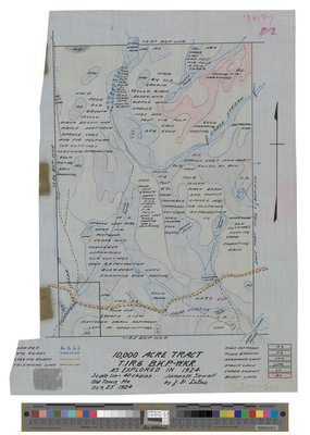
Maine State Archives
Document Type
StillImage
Identifier
04-306013-I005
Description
Map of Township 1 Range 6, BKP, WKR, Chase Stream Township. Shows public lot, roads and telephone lines in 10,000 acre tract in color.
Exact Creation Date
1924
Dimensions
13 x 10 inches
Language
English
Keywords
Maine; Maps; Cartography