

Preview
Contributing Institution
Maine State Archives
Document Type
StillImage
Identifier
4-308519-I041
Description
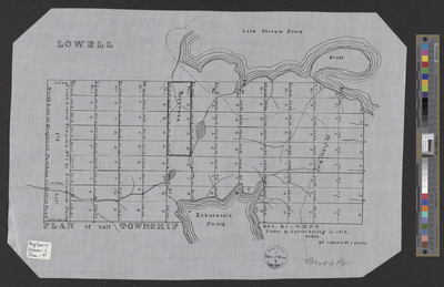
Plan of half of Township 1 Range 1 (T1 R1) NBPP lotted by Andrew Strong in 1818 on a scale of 40 chains to 1 inch.
Exact Creation Date
1818
Language
English
Location
Penobscot County; Lowell
Other Location
Cold Stream Pond; Eskutassis Pond; St. John's Road
Keywords
Cartography; Maps; Surveys