

Preview
Contributing Institution
Maine State Archives
Document Type
StillImage
Identifier
4-308519-I005
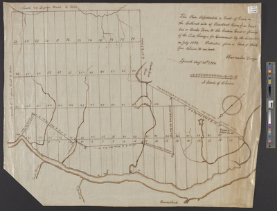
Description
[Brewer] This Plan Representeth A Tract of Land on the Southeast side of Penobscot River From Number One or Bucks Town to the Indian Grant or flowing of the Tide. Surveyed for Government by the Subscriber in July 1784. Protracted from a Scale of thirty five chains to an inch.
Exact Creation Date
8-25-1784
Language
English
Location
Penobscot County; Brewer; Hancock County; Bucksport
Other Location
Treat Stream; Kenduskeag Stream; Souadabscook Stream
Keywords
Cartography; Maps; Surveys