

Preview
Contributing Institution
Maine State Archives
Document Type
StillImage
Identifier
4-304803-I102
Description
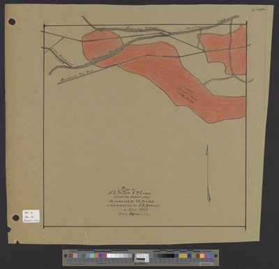
Township 8 Range 8 [T8 R8] WELS - Plan of Northeast 1/4 township showing burnt land. Scale 20 chains to 1 inch.
Exact Creation Date
9-1909
Language
English
Location
Penobscot County; T8 R8 WELS
Other Location
Aroostook River; Mooselook Stream; Millinocket Tote Road
Keywords
Cartography; Maps; Surveys