

Preview
Contributing Institution
Maine State Archives
Document Type
StillImage
Identifier
4-304803-I098
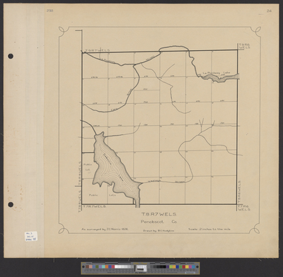
Description
Township 8 Range 7 [T8 R7] WELS as surveyed by Joseph C. Norris in 1826. Drawn by B.C. Hodgkins. Scale 2 inches to 1 mile.
Exact Creation Date
1826
Language
English
Location
Penobscot County; T8 R7 WELS
Other Location
Seboeis Lake; Wadleigh Stream; Cary Brook; La Pomkeag Stream; La Pomkeag Lake
Keywords
Cartography; Maps; Surveys