

Preview
Contributing Institution
Maine State Archives
Document Type
StillImage
Identifier
4-304803-I083
Description
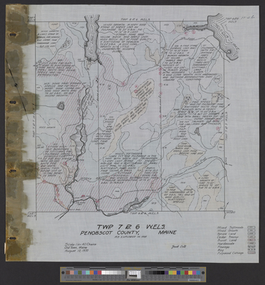
Township 7 Range 6 WELS as explored in 1935. Scale 40 chains to 1 inch.
Exact Creation Date
8-10-1935
Language
English
Location
Penobscot County; T7 R6 WELS
Keywords
Cartography; Maps; Surveys