

Preview
Contributing Institution
Maine State Archives
Document Type
StillImage
Identifier
4-304803-I067
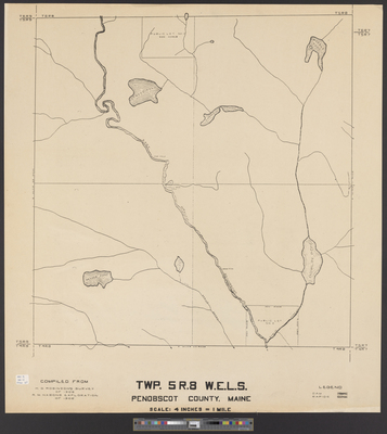
Description
Township 5 Range 8 WELS, Penobscot County, Maine compiled from H.G. Robinson's survey of 1908 and R.M. Nason's exploration of 1906. Scale 4 inches to 1 mile.
Broad Creation Date
1906-1908
Language
English
Location
Penobscot County; T5 R8 WELS
Other Location
East Branch Penobscot River; Marble Pond; Messer Pond; Kimball Pond; Atwood Pond; Stair Falls; Haskell Rock Pitch; Grand Pitch; Little Spring Brook
Keywords
Cartography; Maps; Surveys