

Preview
Contributing Institution
Maine State Archives
Document Type
StillImage
Identifier
4-361695-I009
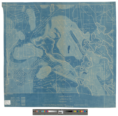
Description
T4 R1 NBPP, Lakeville Plantation. Explored by Mullaney & Dearborn, 1921. Blueprint shows forest type, public lots, and roads.
Scale 2 inches to 1 mile.
Exact Creation Date
1921
Language
English
Location
Penobscot County; Lakeville
Keywords
Cartography; Maps; Surveys