

Preview
Document Type
Image
Contributing Institution
Maine State Library
Description
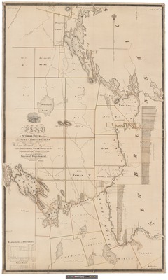
Plan of St. Croix River and the Eastern Branch lakes [cartographic material] : also, a section of the Western Branch : with profiles showing the various elevations of water power and other geological formations : likewise, the adjacent country drawn from the most approved surveys. eveled and surveyed, July, Augt, Sepr, Octr 1836 per order of the Board of Intern at [i.e. Internal] Improvement.
Exact Creation Date
3-7-1837
Dimensions
198 x 119 cm
Language
English
Other Location
St. Croix River, Maine
Keywords
Saint Croix River, Maine; Maps