

Preview
Document Type
StillImage
Contributing Institution
Maine State Library
Identifier
ISMOUN8961
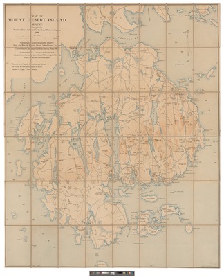
Description
Relief shown by contours and spot heights. "Topography and hydrography adapted from the map of Mount Desert Island issued by hte United States Coast and Geodetic Survey, June 1882." "Nomenclature, revised and corrected, adapted from the map dated June, 1893, compiled for the flora of Mount Desert Island." Map cut into sections and reassembled as one sheet
Exact Creation Date
1896
Language
English
Location
Hancock County
Other Location
Mount Desert Island
Keywords
Maps