

Preview
Document Type
StillImage
Contributing Institution
Maine State Library
Identifier
CA775JE001
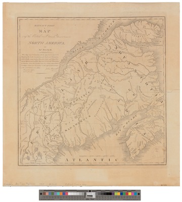
Description
Map with the adjacent parts of New England and Canada, composed from a great number of actual surveys; and other materials regulated by many new astonomical observations of the longitude as well as the latitude.
Exact Creation Date
1775
Language
English
Other Location
Cape Breton; Nova Scotia; Canada
Keywords
Maps; Nova Scotia; Cape Breton