Home
Search
Browse State Agencies
My Account
About
Digital Commons Network™
Skip to main content
Home
About
FAQs
My Account
Home
>
Maine Communities
>
Rockport
>
Camden-Rockport Historical Society
>
CRHS Maps
Camden-Rockport Historical Society Maps
Printing is not supported at the primary Gallery Thumbnail page. Please first navigate to a specific Image before printing.
Follow
Switch View to List
View Slideshow
Map of the first Division of Camden circa 1780
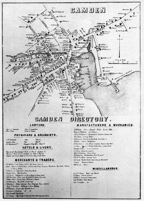
Camden Directory Map, 1859
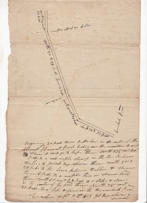
Survey of a road from Mount Pleasant in Rockport over the mountain to Union, 1829
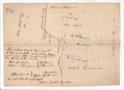
Plan of roads near Spring Brook in Camden, May 1808
Search
Enter search terms:
Select context to search:
in this collection
Digital Maine
Advanced Search
Notify me via email or
RSS
Browse
State Agencies
Subjects
Contributors
For Agency Contributors
FAQs
Featured Links
Maine Government
Maine State Library
Maine State Agencies
Digital Maine Partners
Gallery Locations
View gallery on map
View gallery in Google Earth


