

Preview
Contributing Institution
Maine State Archives
Document Type
Image
Identifier
4-212510-I007
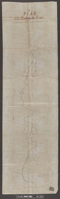
Description
Plan of the Little Madawaska River through T1 R2, WELS (now known as Bancroft).
Scale 10 chains to 1 inch.
Exact Creation Date
1-10-1862
Language
English
Location
Aroostook County; Bancroft
Other Location
T1 R2 WELS
Keywords
Cartography; Maps; Surveys