


Preview
Document Type
Article
Photo Date
5-31-2010
Source of photo date
exif
Survey Date
May 2010
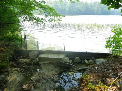
Maine Stream Habitat Viewer Site ID
D0602
Original Image Name
D0602_Downstream_Face.JPG
Coastal Class
Barrier
Crossing Type
unknown
Location
Cumberland County; Baldwin
Waterbody Name
Unnamed Waterbody
Notes
Upstream, water 0.1m below top of structure, no spillover. No GPS coordinates (batteries died) but only outlet on Jackson Lane, South end of Sand Pond. Sand Pond E 0364980, N 4853290