

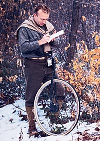
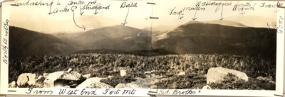
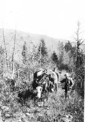
Captain Myron Avery (1899-1952) was born in Lubec, Maine. He followed a career in the U.S. Navy, but his true avocation was the out-of-doors and mountain climbing. He was the first president of the Appalachian Trail Conference and an enthusiastic developer of the Appalachian Trail in Maine.
Images in this gallery are from one of Avery's scrapbooks in the Maine State Library collection. For more information about Maine State Library Collections related to Myron Avery, see the Index to Articles, Books and Manuscripts in the Myron Avery Collection.
Special thanks to Mr. David B. Field, a retired University of Maine professor of Forest Resources and dedicated volunteer with the Appalachian Trail Club for his efforts to digitize these items so that they could be made available online. Additional information about Myron Avery can be found in Mr. Field's book Along Maine's Appalachian Trail.


 by David Field")
 by David Field")


![Cutting Up Mill, Wassataquoik Lake. [Cutting Peeled Spruce Logs to Pulpwood Length.] by David Field](https://digitalmaine.com/avery/1534/thumbnail.jpg "Cutting Up Mill, Wassataquoik Lake. [Cutting Peeled Spruce Logs to Pulpwood Length.] by David Field")


 by David Field")


 by David Field")

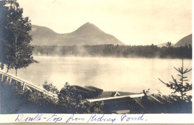
 on Kidney Pond by David Field")


 by David Field")


 by David Field")
 by David Field")


 by David Field")


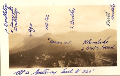
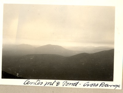
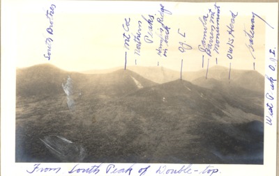
, Looking Towards Russell Mt. and Ridges North of Russell by David Field")
 by David Field")


 by David Field")


 by David Field")


 Camp At Kidney Pond by David Field")
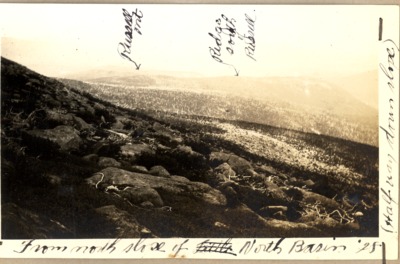
, Hamlin Ridge, North Basin by David Field")
 by David Field")


 by David Field")


 by David Field")


 by David Field")


 by David Field")


 by David Field")


, Tip-Top by David Field")


 by David Field")


 by David Field")


 by David Field")

 by David Field")
 by David Field")
 by David Field")


 by David Field")
 (J.E. Mahar) by David Field")


 by David Field")
 by David Field")

, Perkins by David Field")

. by David Field")
 by David Field")


 by David Field")


 by David Field")

 by David Field")


, Tableland Mt. Katahdin (Dr. Rogers) by David Field")


 by David Field")
 by David Field")

 by David Field")
 by David Field")
 by David Field")
 by David Field")


 by David Field")


 by David Field")


 by David Field")


 by David Field")


 by David Field")
 by David Field")


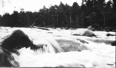
. Abol Falls, West Branch Penobscot. by David Field")


 by David Field")
. Probably Built by Tracey. by David Field")


 by David Field")

 by David Field")

 from South Shore Thissell Pond by David Field")

 (L. Rogers) by David Field")


 by David Field")


 by David Field")


 by David Field")


 Used in Appalachia by David Field")


 (L. Rogers) by David Field")
 by David Field")
 by David Field")
 by David Field")
 (Looks Like A Bird Hunting Expedition) by David Field")

 by David Field")

 by David Field")
 by David Field and E. Anters")
 by David Field and Myron Avery")

 by David Field and W. J. Dawson")
 by David Field and W. J. Dawson")

 by David Field and Parker Field")
 by David Field and Rex Gilpatrick")

 by David Field and F. B. Hyde")
 by David Field and W. A. Judge")
 by David Field and J. E. Mahar")
 by David Field and L. Rogers")
 by David Field and L. Rogers")
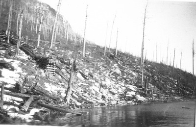
. Marking Limit of 1884 Fire. by David Field and L. Rogers")
. Marking Limit of 1884 Fire. by David Field and L. Rogers")
 by David Field and L. Rogers")
 Dr. Rogers’ Pictures (Plate Camera) Were Taken 1900-1902 by David Field and L. Rogers")
 by David Field and L. Rogers")
 by David Field and Luther Rogers")
 by David Field and Luther Rogers")
 by David Field and J. C. Mahar")
 by David Field")
 by David Field")
 by David Field")


 by David Field")

 by David Field")


 by David Field and Shaiker Philbrick")
 by David Field")
 by David Field")


 by David Field")
, 1930 (J.C.Mahar) by David Field")
 Trout, 1929 by David Field")
 by David Field")


 by David Field")


 by David Field")

 and J. Frank Schairer Fishing At Dwelley Pond, 1929 by David Field")


 by David Field")


 by David Field")
 by David Field and J. C. Mahar")
 by David Field and J. C. Mahar")
 by David Field and J. C. Mahar")
 by David Field and J. C. Mahar")
 by David Field and J. E. Mahar")

 from East. 1928 by David Field")

 by David Field")
 by David Field")


 by David Field")

 by David Field")

 by David Field")


 by David Field")


 by David Field")
 by David Field")


 by David Field")


 by David Field")
 by David Field")

 by David Field")
 by David Field")
 by David Field")


 by David Field")


 by David Field")
 by David Field")


 by David Field")


 by David Field")
 by David Field")


 by David Field")


 by David Field and E. Anters")
 by David Field and E. Anters")

 by David Field")
 by David Field")
 by David Field")
 by David Field")
. by David Field")
 by David Field")
 by David Field")
 by David Field")

 by David Field")
 by David Field")


 by David Field")
 by David Field")

 by David Field")

 by David Field")
, Tableland Mt. Katahdin, 1924 (Dr. Rogers) by David Field")
 by David Field")
 Camp At Chimney Pond, Built in 1924. (Luther Rogers, 1924) by David Field")


. from near Monument Peak, Looking Towards Pamola. by David Field")

, Chimney Pond, Basin Ponds, Turner, 1923 by David Field")
 by David Field and Luther Rogers")
 by David Field and A. W. K. Sweet")
 by David Field")


 by David Field")
 by David Field")
 by David Field")
 by David Field")

 by David Field")


 Snow on This Mt. to Smart Sluice to Middle Branch, Russell Mt. Trip Feb. 18-23, 1914 by David Field")
 by David Field")


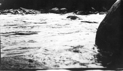
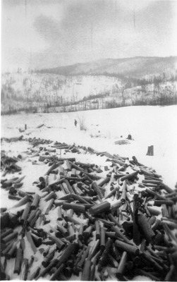
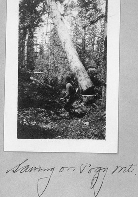
![Pogy Sluice, 1914 (Ben Morse) [Looks Like A Cutoff Saw.] by David Field](https://digitalmaine.com/avery/1517/thumbnail.jpg "Pogy Sluice, 1914 (Ben Morse) [Looks Like A Cutoff Saw.] by David Field")
 by David Field")
 by David Field")
 by David Field")
 by David Field")
 by David Field")
 by David Field")
![Top of Pogy Sluice, 1914 (Ben Morse) [Again, Looks Like A Cutoff Saw] by David Field](https://digitalmaine.com/avery/1522/thumbnail.jpg "Top of Pogy Sluice, 1914 (Ben Morse) [Again, Looks Like A Cutoff Saw] by David Field")
 by David Field")
 by David Field and B. E. Morse")

 by David Field and Ben Morse")
 by David Field and B. E. Morse")
 by David Field and B. E. Morse")
 by David Field")
 by David Field")
 by David Field")
 by David Field")

 by David Field")
 by David Field and L. Rogers")
 and Frank Mckenney, Guide, Patten. (Amy C. Witherle) by David Field")


 by David Field")
 With Guides. (Amy Witherle) by David Field and Amy Witherle")
, Frank Mckenney (Guide). (Amy C. Witherle) by David Field and Amy C. Witherle")
. (Mansfield—Trip With L. Rogers in 1900) by David Field")
, Guide George Mckenney (Left) (Photo Probably by Amy Witherle) by David Field")
, George & Frank Mckenney (Guides). (Photo by Amy Witherle) by David Field and Amy C. Witherle")


 by David Field")
. Reed’S Upper Dam. by David Field")
 by David Field")