


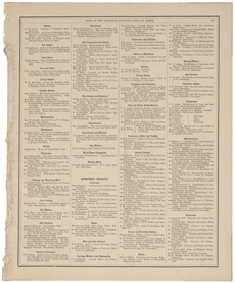
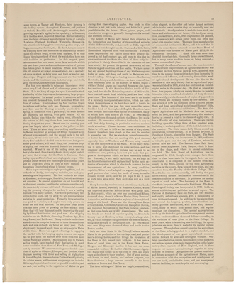
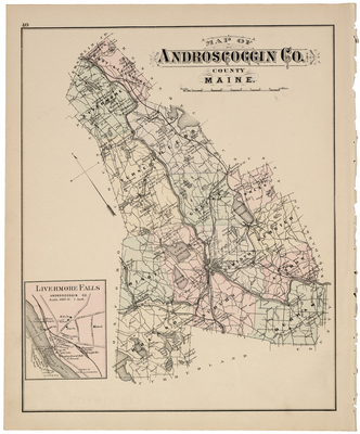
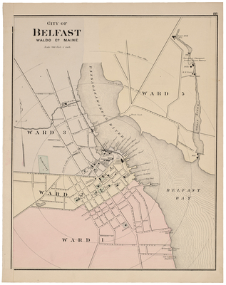
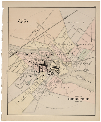
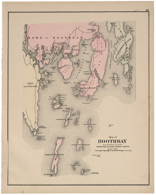
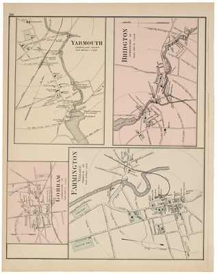
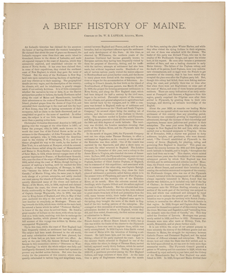
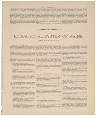
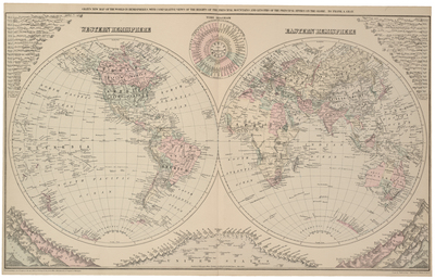
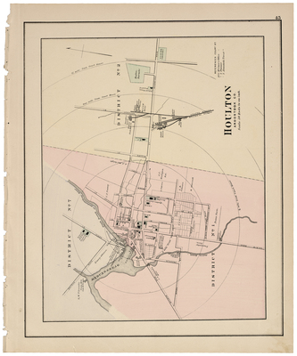
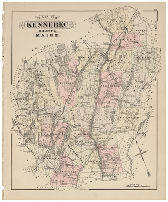
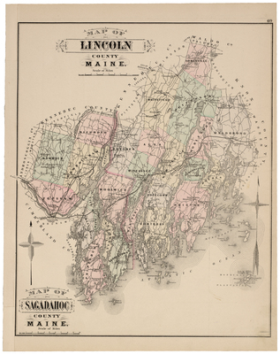
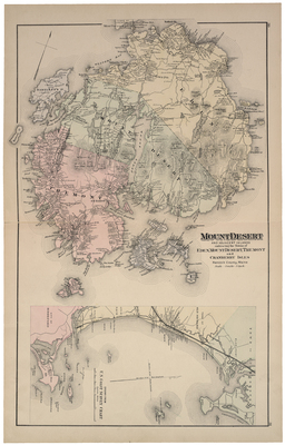
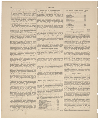
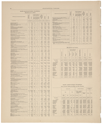
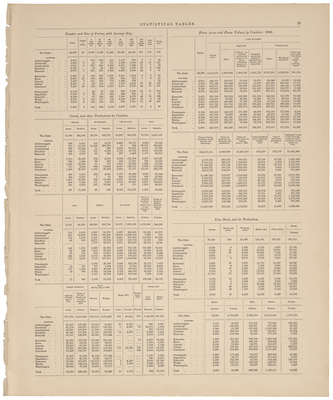
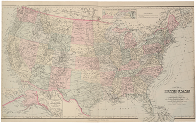
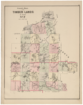
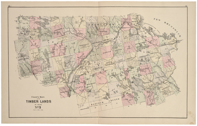
Atlas of the State of Maine. Including Statistics and Descriptions of Its History, Educational System, Geology, Rail Roads, Natural Resources, Summer Resorts and Manufacturing Interests. Compiled and Drawn from Official Plans and Actual Surveys and Published by George N. Colby & Co., Houlton, ME, 1884.
Printing is not supported at the primary Gallery Thumbnail page. Please first navigate to a specific Image before printing.


