• Home
  • Search
  • Browse State Agencies
  • My Account
  • About
  • DC Network Digital Commons Network™
Skip to main content
Digital Maine Maine State Library
  • Home
  • About
  • FAQs
  • My Account

Home > StateDocs > sos > ARCHIVES > ARC_IMG > ARC_MAPS > ATLASES > ATLAS_CUMBERLAND_1871

Cumberland County
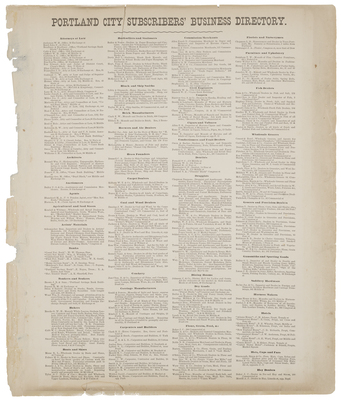
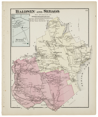
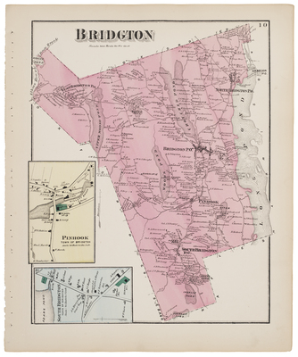
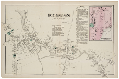
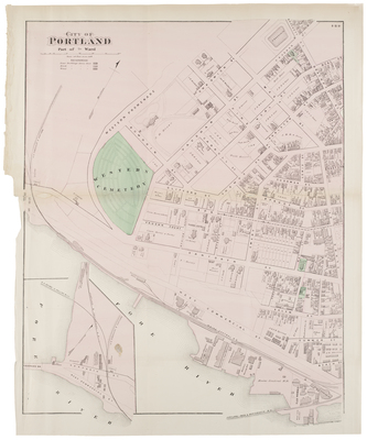
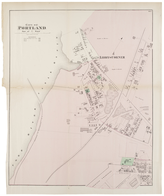
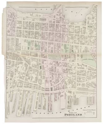
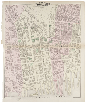
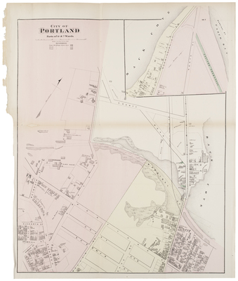
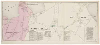
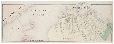
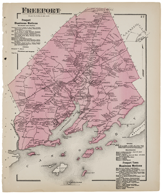
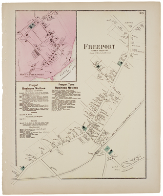
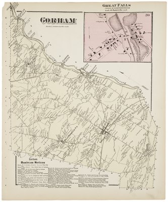
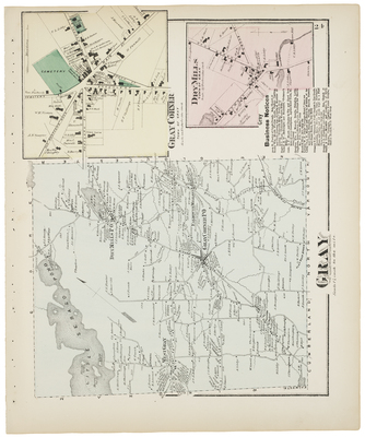
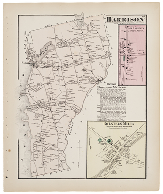
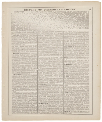
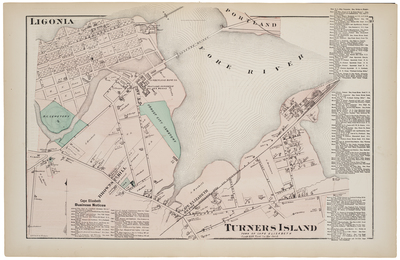
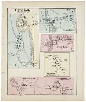
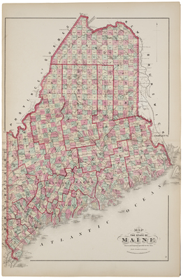
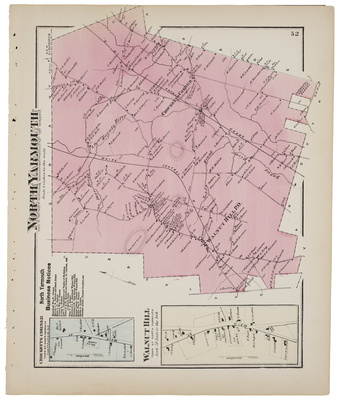
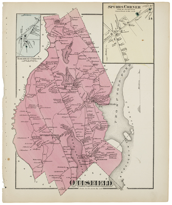
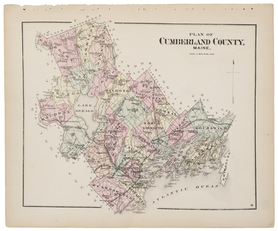
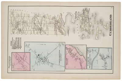
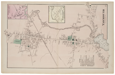
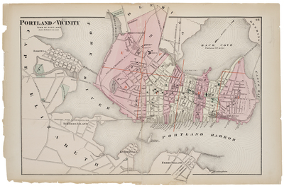
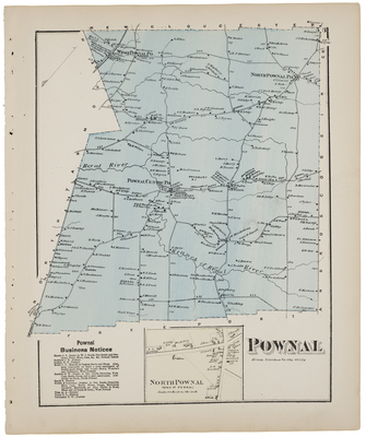
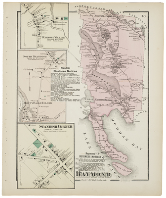
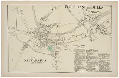
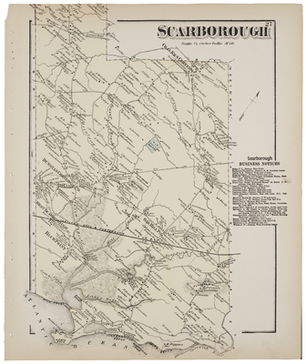
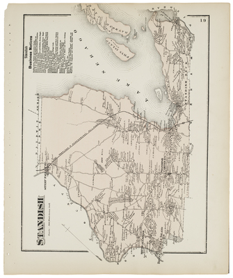
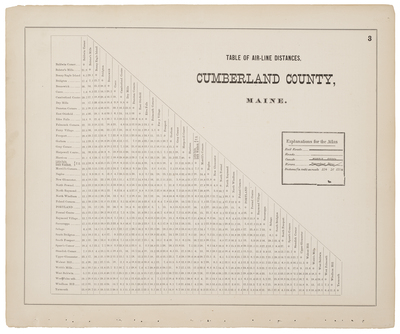
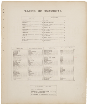
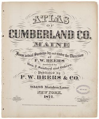
Atlas of Cumberland County, Maine. From Actual Surveys by and under the Direction of F.W. Beers. Assisted by Geo. P. Sanford and Others. Published by F.W. Beers & Co., 93 & 95 Maiden Lane, New York, 1871.
Printing is not supported at the primary Gallery Thumbnail page. Please first navigate to a specific Image before printing.

Follow

Switch View to List View Slideshow
 
  • Harrison Bolsters Mills Harrison Business notices

    Harrison Bolsters Mills Harrison Business notices

  • History of CumberlandCounty

    History of CumberlandCounty

  • Ligonia Turners Island

    Ligonia Turners Island

  • Little Falls Gambo Falls Steep Falls West Gorham Windham Hill Windham Centre

    Little Falls Gambo Falls Steep Falls West Gorham Windham Hill Windham Centre

  • Map of State of Maine

    Map of State of Maine

  • Morrill's Corner Woodfords

    Morrill's Corner Woodfords

  • Naples Edes Falls Town of Naples Naples business notices

    Naples Edes Falls Town of Naples Naples business notices

  • New Gloucester, Blue Point, Coal Kiln Corners, Gloucester Hill, Falmouth Mills, Upper Gloucester, Dustan Corner

    New Gloucester, Blue Point, Coal Kiln Corners, Gloucester Hill, Falmouth Mills, Upper Gloucester, Dustan Corner

  • North Windham Windham Popeville

    North Windham Windham Popeville

  • North Yarmouth Crocketts Corner Walnut Hill

    North Yarmouth Crocketts Corner Walnut Hill

  • Otisfield Baldwin Corner Spurrs Corner

    Otisfield Baldwin Corner Spurrs Corner

  • Plan of CumberlandCounty Maine

    Plan of CumberlandCounty Maine

  • Poland Corners Cumberland Center Cumberland New Casco Falmouth or Presumscott Falls

    Poland Corners Cumberland Center Cumberland New Casco Falmouth or Presumscott Falls

  • Porters Landing Yarmouth Mast Landing

    Porters Landing Yarmouth Mast Landing

  • Portland

    Portland

  • Portland and vincinty Portland Harbor Back Cove

    Portland and vincinty Portland Harbor Back Cove

  • Pownal North Pownal

    Pownal North Pownal

  • Raymond Raymond Village South Standish Standish Corner

    Raymond Raymond Village South Standish Standish Corner

  • Saccarappa CumberlandMills

    Saccarappa CumberlandMills

  • Scarborough

    Scarborough

  • Standish

    Standish

  • Table of air-line distances Cumberland County Maine

    Table of air-line distances Cumberland County Maine

  • Table of Contents

    Table of Contents

  • Title page

    Title page

 
  • 1
  • 2
  • 3


Search

Advanced Search

  • Notify me via email or RSS

Browse

  • State Agencies
  • Subjects
  • Contributors

For Agency Contributors

  • FAQs

Featured Links

  • Maine Government
  • Maine State Library
  • Maine State Agencies
  • Digital Maine Partners

Gallery Locations

  • View gallery on map
  • View gallery in Google Earth
 
Elsevier - Digital Commons

Home | About | FAQ | My Account | Accessibility Statement

Privacy Copyright