


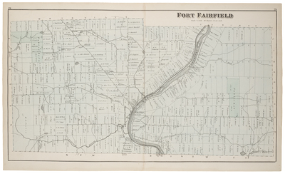
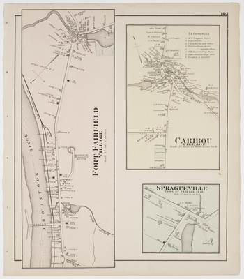
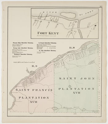
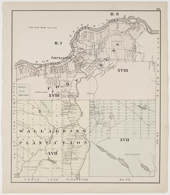
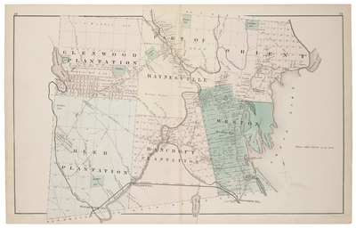
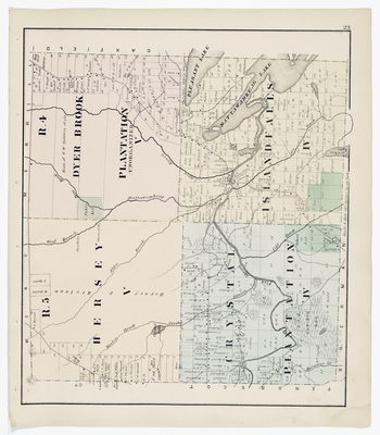
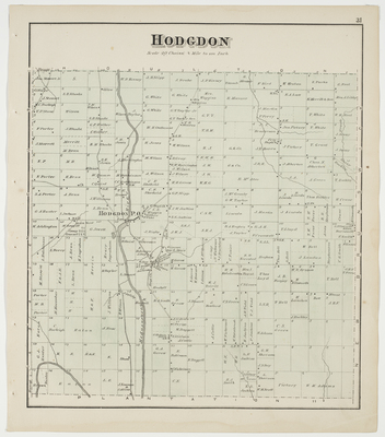
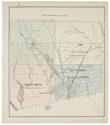
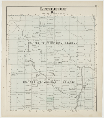
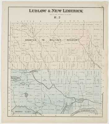
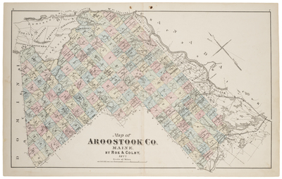
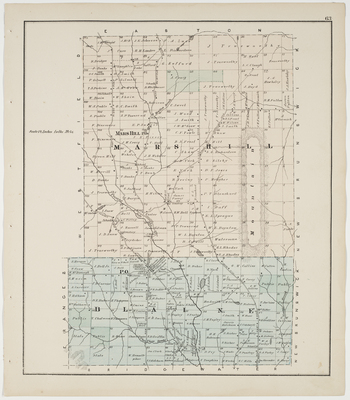
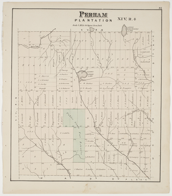
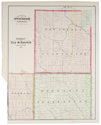
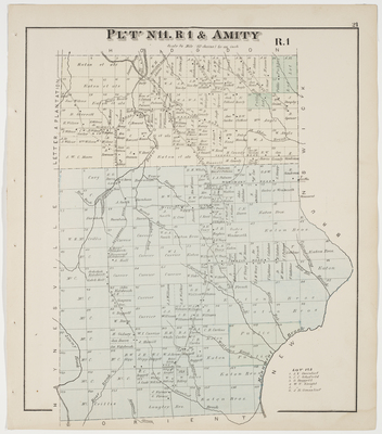
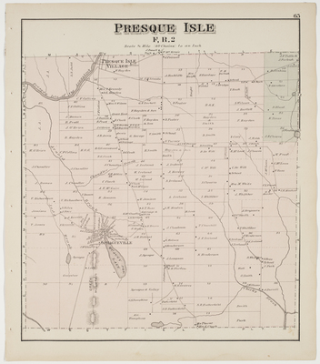
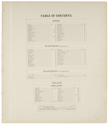
Atlas of Aroostook County, Maine. Compiled and Drawn from Official Plans and Actual Surveys by F. B. Roe & N.Geo. Colby. Published by Roe & Colby, 27 South 6th Street, Philadelphia, PA, 1877.
Printing is not supported at the primary Gallery Thumbnail page. Please first navigate to a specific Image before printing.
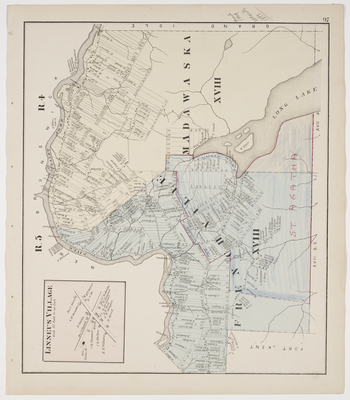
, St. Agatha & Madawaska (T18R4)")
")


")

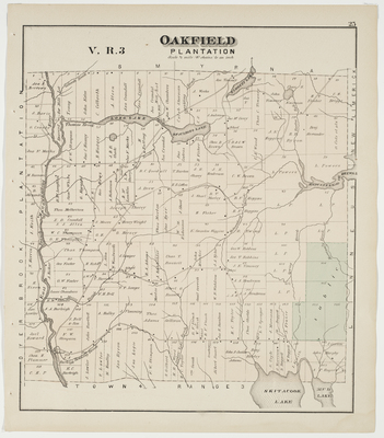
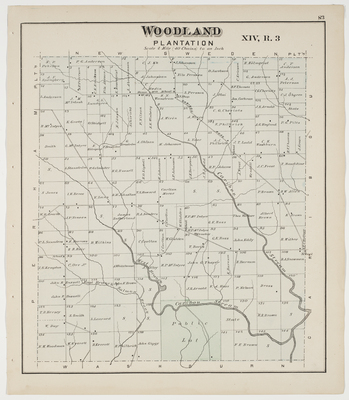
 & T13-17 R3-6")
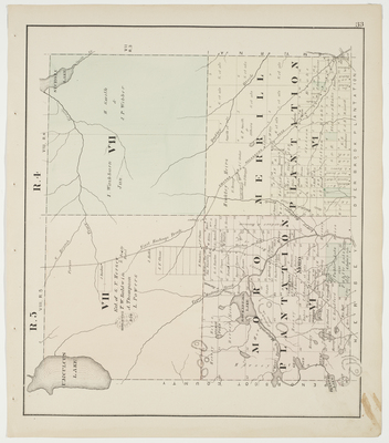
, Merrill Plantation (T6R4), T7R5 & T7R4")
")
 Aroostook Cty. Atlas 1877-29067.jpg")
")

")

")
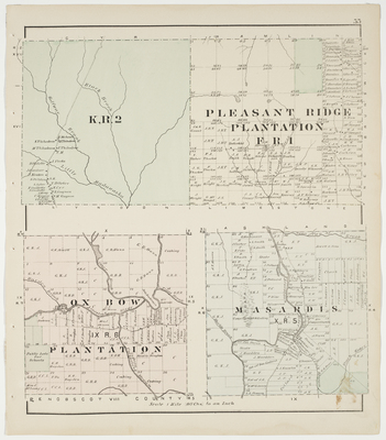
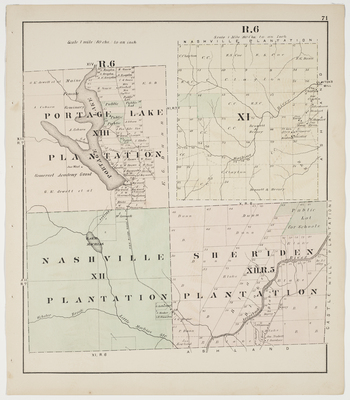
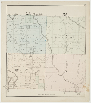
, Nashville (T12R6) & Sheriden (T12R5) Plantations")

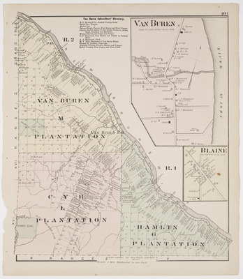
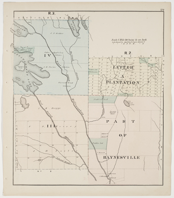
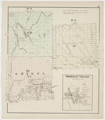
, Letter 'B' R2, Sherman Village")


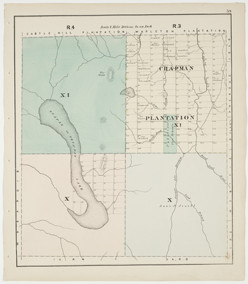
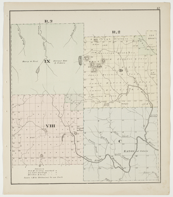
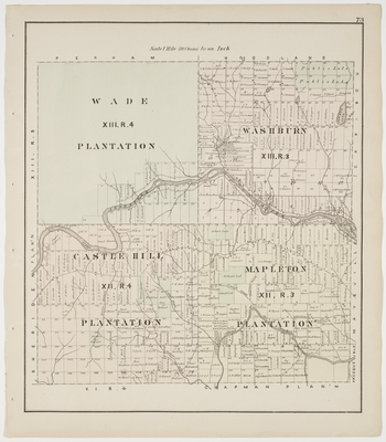
 & Wade (T13R4), Castle Hill (T12R4) & Mapleton (T12R3) Plantations")