• Home
  • Search
  • Browse State Agencies
  • My Account
  • About
  • DC Network Digital Commons Network™
Skip to main content
Digital Maine Maine State Library
  • Home
  • About
  • FAQs
  • My Account

Home > StateDocs > sos > ARCHIVES > ARC_IMG > ARC_MAPS > ARC_RR_MAPS

Railroad Maps and Plans

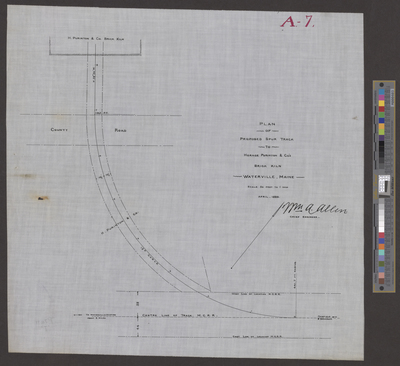
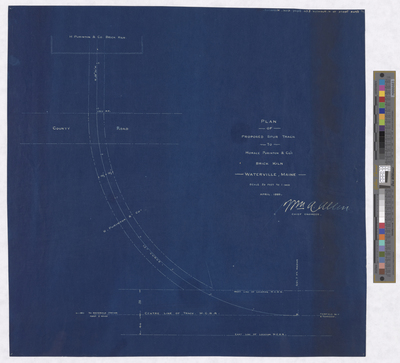
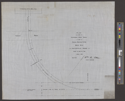
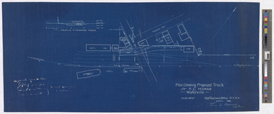
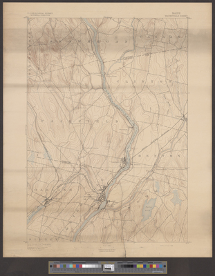
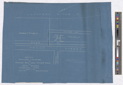
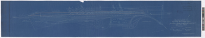
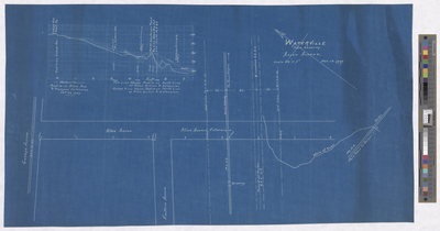
In 1858, the Maine Legislature passed a law establishing the railroad commissioners, who were responsible for overseeing railroads in the State. In 1913, with the creation of the Public Utilities Commission, the railroad commissioners were abolished and railroads were then regulated by the PUC. From the 1880s to 1910s many railroad plans had to be approved by the commissioners of these bodies. As a result, the Maine State Archives now has a large collection of maps and plans from railroads throughout the state.
Printing is not supported at the primary Gallery Thumbnail page. Please first navigate to a specific Image before printing.

Follow

Switch View to List View Slideshow
 
  • Plan Showing Land Required by Maine Central R.R. Co. for necessary tracks for addition to terminal yard, Waterville, Maine by Maine Central Railroad and Theo L. Dunn

    Plan Showing Land Required by Maine Central R.R. Co. for necessary tracks for addition to terminal yard, Waterville, Maine

  • Waterville Plan Showing Allen Avenue by Maine Central Railroad

    Waterville Plan Showing Allen Avenue

 
  • 1
  • 2


Search

Advanced Search

  • Notify me via email or RSS

Browse

  • State Agencies
  • Subjects
  • Contributors

For Agency Contributors

  • FAQs

Featured Links

  • Maine Government
  • Maine State Library
  • Maine State Agencies
  • Digital Maine Partners

Gallery Locations

  • View gallery on map
  • View gallery in Google Earth
 
Elsevier - Digital Commons

Home | About | FAQ | My Account | Accessibility Statement

Privacy Copyright