

Preview
Document Type
StillImage
Contributing Institution
Maine State Archives
Identifier
29-323416-F001-I001
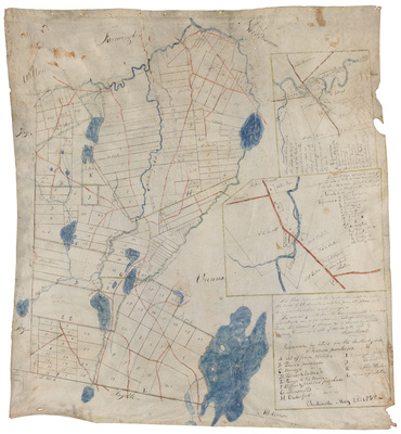
Description
This plan represents the land, water, roads, etc. within the town of Chesterville, as taken from old plans, with some corrections from recent surveys. The several grants from the Commonwealth to individuals are, (so far as known), distinguished by colored lines. The current of streams, etc. is shown by small arrows. Drawn on a scale of 100 rods to the inch, by Oliver Sewall.
Exact Creation Date
5-22-1838
Language
English
Location
Franklin County; Chesterville
Keywords
Maine; Survey; Map; Chesterville