

Preview
Document Type
StillImage
Contributing Institution
Maine State Archives
Identifier
206949
Description
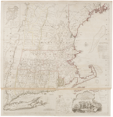
This large, detailed map of New England was compiled by Braddock Mead (alias John Green), and first published by Thomas Jefferys in 1755. Green was an Irish translator, geographer, and editor, as well as one of the most talented British map-makers at mid-century. The map was re-published at the outset of the American Revolution, as it remained the most accurate and detailed survey of New England.
Of interest are engraved double lines found beneath certain place-names, including Boston. These lines indicate cities whose longitude had been calculated with the aid of the newly invented marine chronometer. Includes compilation data and insets of "A plan of the town of Boston" and "A plan of Boston Harbor from an accurate survey."
Broad Creation Date
1774
Language
English
Other Location
New England
Keywords
Cartography; Maps; British Colonies