

Preview
Document Type
StillImage
Contributing Institution
Maine State Archives
Identifier
206949
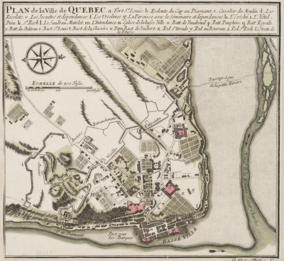
Description
Plan of the city of Quebec circa 1764. Cartographer is unknown but the map is based upon Jacques Bellin's map of the same period.
Broad Creation Date
1764
Dimensions
12" x 13"
Language
French
Other Location
Canada
Keywords
Cartography; Maps