

Preview
Contributing Institution
Maine State Archives
Document Type
StillImage
Identifier
29453
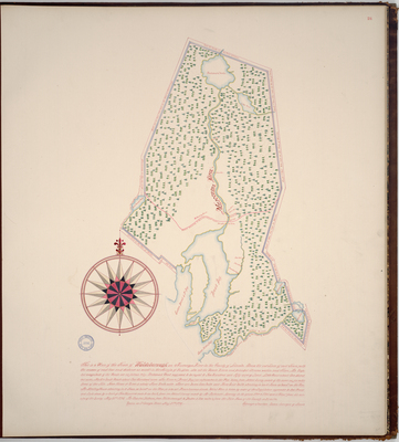
Description
Page 24 of the Lincoln County planbook. Survey of the town of Waldoboro using a scale of 200 rods to an inch based upon an earlier survey by Nathaniel Meservey in 1794.
Exact Creation Date
5-27-1796
Language
English
Location
Lincoln County; Waldoboro
Other Location
Goose River Bay; Broad Bay; Muscongus River; Northern Pond; South Pond; Medomack Pond; Duck Puddle Pond; Little Pond
Keywords
Cartography; Maps; Maine Land Office; Planbooks; Surveys
Image Location
Rights Statement
No Copyright - United States. URI: http://rightsstatements.org/vocab/NoC-US/1.0/
The organization that has made the Item available believes that the Item is in the Public Domain under the laws of the United States, but a determination was not made as to its copyright status under the copyright laws of other countries. The Item may not be in the Public Domain under the laws of other countries. Please refer to the organization that has made the Item available for more information.