


Files
Download Map (1.9 MB)
Document Type
StillImage
Description
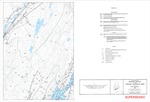
Maine Geological Survey, Open-File Map 92-58 (Superseded by West, 2016, Maine Geological Survey Open-File 16-27)
Publication Code
92-58
Publication Date
1-1-1992
Publisher
Maine Geological Survey
Superceded by
Location
Kennebec County; Lincoln County; Sagadahoc County
Map Type
Bedrock Geology Maps (scale 1:24,000)
Map Scale
1:24000
Recommended Citation
Newberg, Donald W., 1992, Reconnaissance bedrock geology of the Wiscasset 7.5' quadrangle, Maine: Maine Geological Survey, Open-File Map 92-58 (Superseded by West, 2016, Maine Geological Survey Open-File 16-27), map, scale 1:24,000. Maine Geological Survey Maps. 17. http://digitalmaine.com/mgs_maps/17
Rights Statement

No Copyright - United States. URI: http://rightsstatements.org/vocab/NoC-US/1.0/
The organization that has made the Item available believes that the Item is in the Public Domain under the laws of the United States, but a determination was not made as to its copyright status under the copyright laws of other countries. The Item may not be in the Public Domain under the laws of other countries. Please refer to the organization that has made the Item available for more information.