


Files
Download Map (13.7 MB)
Document Type
StillImage
Description
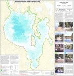
Maine Geological Survey, Open-File Map 98-123. Shoreline classifications on the map provide information on the type and erodability of sediments along the shore. Bathymetry for lake bottom also shown.
Publication Code
98-123
Publication Date
1-1-1998
Publisher
Maine Geological Survey
Location
Cumberland County
Map Type
Lake Studies
Map Scale
1:24000
Recommended Citation
Johnston, Robert A., 1998, Shoreline classification of Sebago Lake: Maine Geological Survey, Open-File Map 98-123, map, scale 1:24,000. Maine Geological Survey Maps. 1218. http://digitalmaine.com/mgs_maps/1218
Rights Statement

No Copyright - United States. URI: http://rightsstatements.org/vocab/NoC-US/1.0/
The organization that has made the Item available believes that the Item is in the Public Domain under the laws of the United States, but a determination was not made as to its copyright status under the copyright laws of other countries. The Item may not be in the Public Domain under the laws of other countries. Please refer to the organization that has made the Item available for more information.