

Preview
Document Type
StillImage
Contributing Institution
Maine State Archives
Identifier
206947
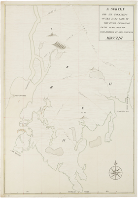
Description
Neskeag Point, Cape Rosier, Fort Pownal, fort ruins at Castine, Blue Hill, Placentia Bay, and Mount Desert River are depicted. Cartographer unknown. Map dates from after 1760.
Language
English
Other Location
Maine
Keywords
Cartography; Maps; Province of Maine