

Preview
Document Type
StillImage
Contributing Institution
Maine State Archives
Identifier
210870
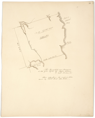
Description
Survey of Robbinston containing 17,860 acres.
Exact Creation Date
1784
Language
English
Location
Washington County; Robbinston
Other Location
Liberty Point; East Pond; Moose Horn Brook; Schoodic Bay
Keywords
Cartography; Maps; Maine Land Office; Planbooks; Surveys
Image Location
Rights Statement
No Copyright - United States. URI: http://rightsstatements.org/vocab/NoC-US/1.0/
The organization that has made the Item available believes that the Item is in the Public Domain under the laws of the United States, but a determination was not made as to its copyright status under the copyright laws of other countries. The Item may not be in the Public Domain under the laws of other countries. Please refer to the organization that has made the Item available for more information.