Home
Search
Browse State Agencies
My Account
About
Digital Commons Network™
Skip to main content
Home
About
FAQs
My Account
Home
>
Maine Communities
>
Bar Harbor, Maine
>
MDI_MAPS
Mount Desert Island Maps
Printing is not supported at the primary Gallery Thumbnail page. Please first navigate to a specific Image before printing.
Follow
Switch View to List
View Slideshow
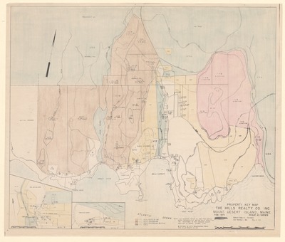
Property Key Map, The Hills Realty Co. Inc. Mount Desert Island, Maine
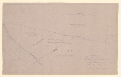
Plan Showing Property of Wallace K. Harrison of Seal Harbor, Maine
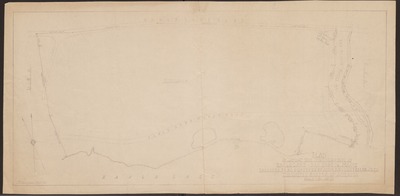
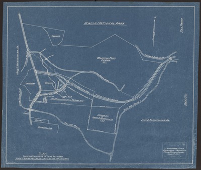
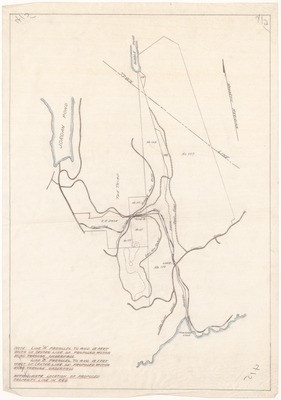
Plan of Land at the Northern End of Eagle Lake - Bar Harbor, Maine Proposed to be Conveyed by John D. Rockefeller to the United States of America
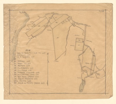
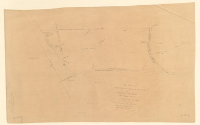
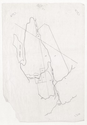
Property Lots Adjacent to Acadia National Park on the Eastern Side of Eagle Lake
Great Meadow Hill Area; Acadia National Park and Adjoining Properties
Wildwood Farm Extension - Proposed Park Motor Road
Plot Plan of Reservation and Life Estate of George B. Dorr, Bar Harbor, Maine
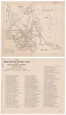
1941 Cottage Directory and Key to Map (Northeast Harbor, Maine)
Mount Desert Island, Maine Showing Lots Comprising and Adjacent to Acadia National Park
Mount Desert Island Property Map Showing Land Owned by Federal Government, John D. Rockefeller, Jr.; and George Dorr
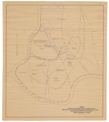
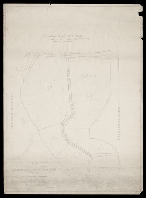
Plan Showing Sewer Rights and Building Restriction Lines on Properties Formerly of the Seal Harbor Reality Company, Seal Harbor, Maine
Property Map Showing E.B. Dane Land at Wildwood Farm and Other Nearby Lots
Property Map Showing Lots and Land Belonging to Acadia National Park in a Region West of Somes Sound on Mount Desert Island
Property Map Showing Lots Near Otter Creek and Hunters Beach, Mount Desert Island, Maine
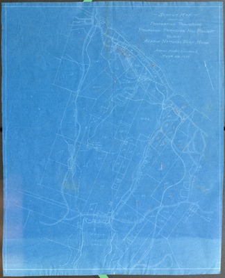
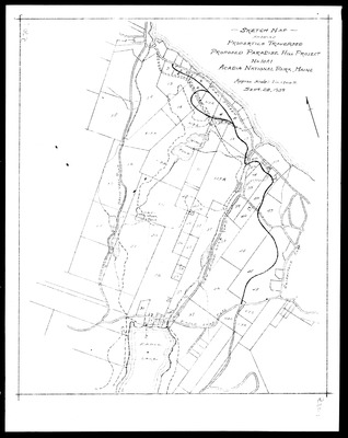
Sketch Map Showing Properties Traversed Proposed Paradise Hill Project No 10A1, Acadia National Park, Maine
Sketch Map Showing Properties Traversed; Proposed Paradise Hill Project No. 10A1; Acadia National Park, Maine; Sept 28, 1939
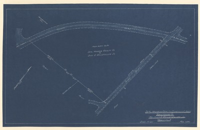
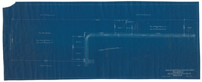
Proposed Motor Road Through Underpass Near Wildwood Farm (Dane Farm)
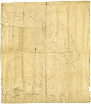
Plan of Thirlstane; Owned by William Pierson Hamilton; Bar Harbor, ME
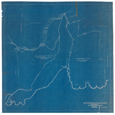
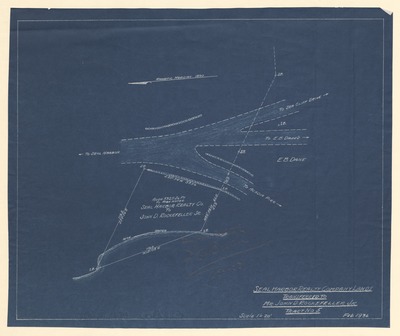
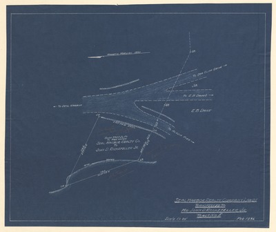
Seal Harbor Realty Company Lands; John D. Rockefeller, Jr. to Acadia National Park
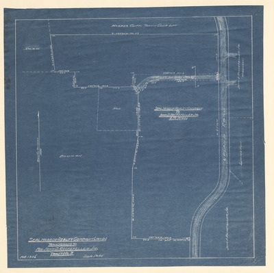
Seal Harbor Realty Company Lands Transferred to Mr. John D. Rockefeller, Jr. Tract No. 1
Seal Harbor Realty Company Lands Transferred to Mr. John D. Rockefeller, Jr. Tract No. 3
Seal Harbor Realty Company Lands Transferred to Mr. John D. Rockefeller, Jr. Tract No. 4.
Seal Harbor Realty Company Lands Transferred to Mr. John D. Rockefeller, Jr. Tract No. 5.
Seal Harbor Realty Company Lands Transferred to Mr. John D. Rockefeller, Jr. Tract No. 5.
Seal Harbor Realty Company Lands Transferred to Mr. John D. Rockefeller, Jr. Tract No. 6 / 6a
Seal Harbor Realty Company Lands Transferred to Mr. John D. Rockefeller, Jr. Tract No. 6 / 6a
Seal Harbor Realty Company Lands Transferred to Mr. John D. Rockefeller, Jr. Tract No. 7. Handwritten note on map reads "4 in deed."
Seal Harbor Realty Company Lands Transferred to Mr. John D. Rockefeller, Jr. Tract No. 8
Seal Harbor Realty Company Lands Transferred to Mr. John D. Rockefeller, Jr. Tract No. 9
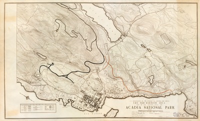
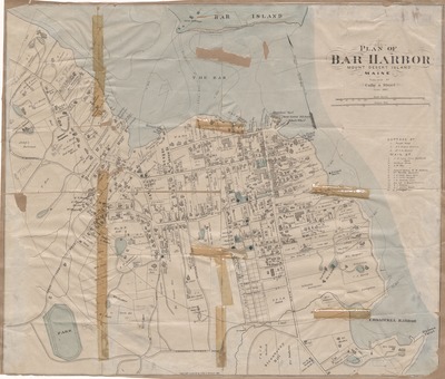
The Bar Harbor Area Part of the Master Plan for Acadia National Park
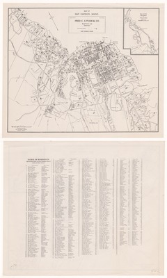
Map of Bar Harbor, Maine and Index of Residents (1935?)
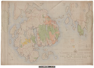
The Road System Part of the Master Plan for Acadia National Park : Drawn by Branch of Plans and Design from National Park Service Data as of January 1, 1935
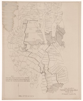
Map Showing the Tremont Purchase Area, Maine R-2, Mt. Desert Island, Me
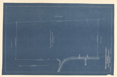
Property Map Showing Land for Park Office Adjacent to Ledgelawn Avenue, Bar Harbor, Maine
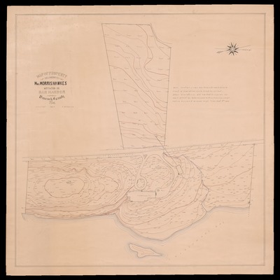
Map of Property Belonging to Mrs. Morris Hawkes Situated in Bar Harbor, Hancock County, Maine 1925
Map of Seal Harbor Mount Desert Maine from George L Stebbins Real Estate
Map of Bar Harbor, Maine and Index of Residents 1907
Plan of "Sonogee" Bar Harbor, 1907
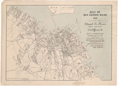
Map of Bar Harbor, Maine 1906
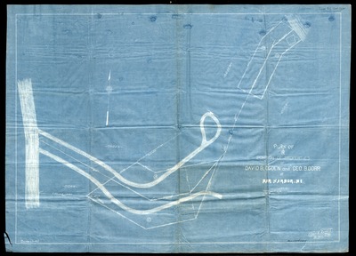
Plan of a Portion of Properties of David B. Ogden and George B. Dorr at Bar Harbor, Me
Property Map Showing Lots Near Otter Creek
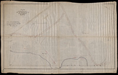
Plan of Property of William M. Roberts, Bar Harbor Maine
Map of Bar Harbor, Maine 1895
A Plan of Land at N.E. Harbor Owned by Mrs. Hanna Smallidge, Surveyed Sept. 1891
Plan of High Head Owned by the Bar Harbor Island, Land 7 Investment Co. in the Towns of Eden and Mt. Desert, Me.; March, 1888
Plan of Bar Harbor, Mount Desert Island, Maine (1887)
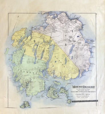
Mount Desert and Adjacent Islands Embracing the Towns of Eden, Mount Desert, Tremont and Cranberry Isles, Hancock County Maine
Search
Enter search terms:
Select context to search:
in this collection
Digital Maine
Advanced Search
Notify me via email or
RSS
Browse
State Agencies
Subjects
Contributors
For Agency Contributors
FAQs
Featured Links
Maine Government
Maine State Library
Maine State Agencies
Digital Maine Partners
Gallery Locations
View gallery on map
View gallery in Google Earth


 by The Knowles Company")


")


 by Fred C. Lynam & Co")


 by Colby & Stuart")
