• Home
  • Search
  • Browse State Agencies
  • My Account
  • About
  • DC Network Digital Commons Network™
Skip to main content
Digital Maine Maine State Library
  • Home
  • About
  • FAQs
  • My Account

Home > StateDocs > sos > ARCHIVES > ARC_IMG > ARC_MAPS > ATLASES > ATLAS_HANCOCK_1881

Hancock County
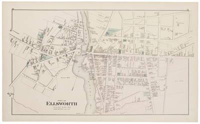
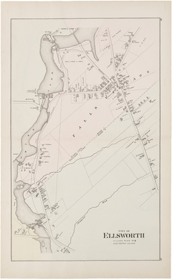
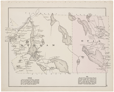
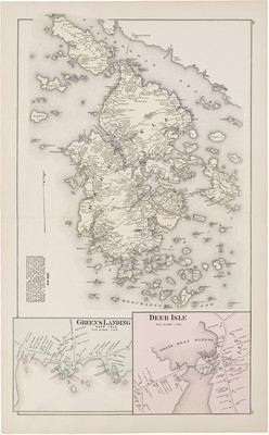
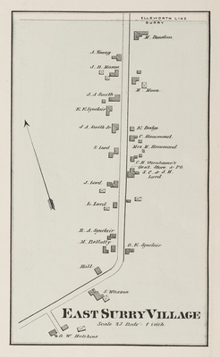
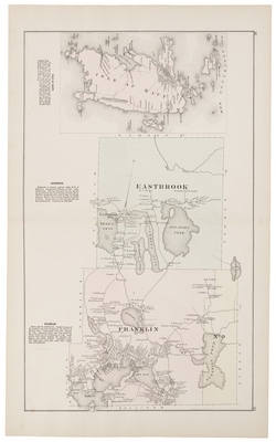
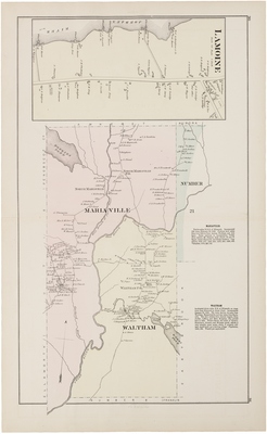
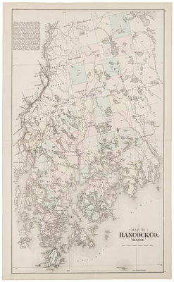
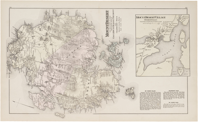
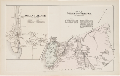
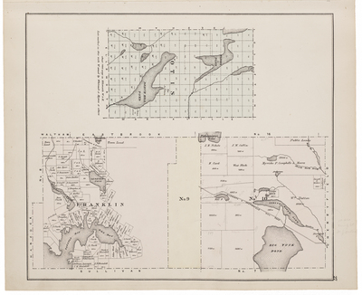
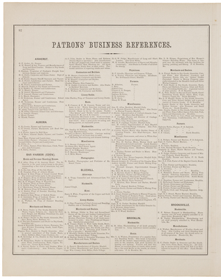
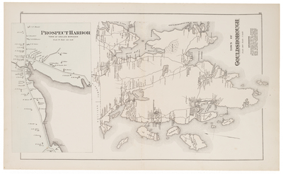
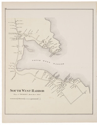
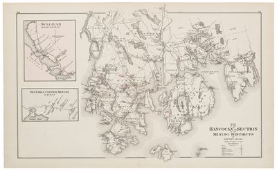
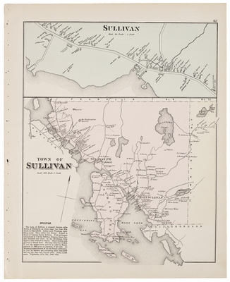
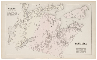
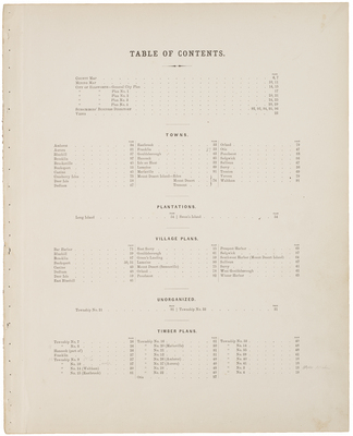
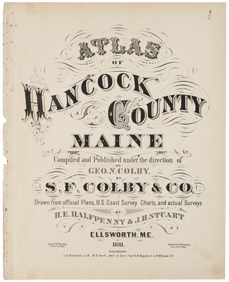
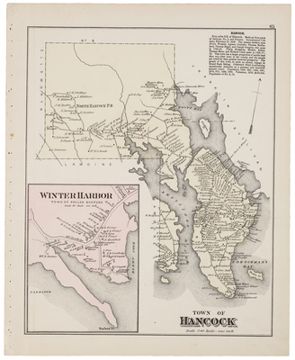
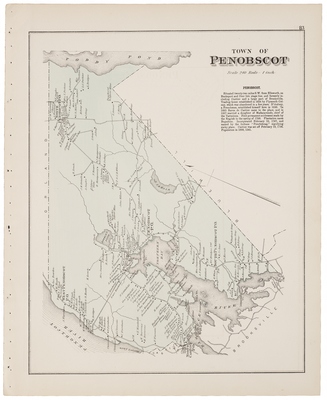
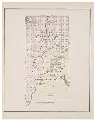
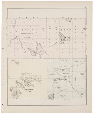
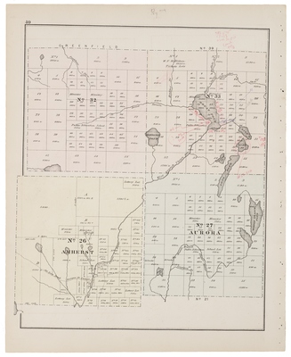
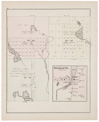
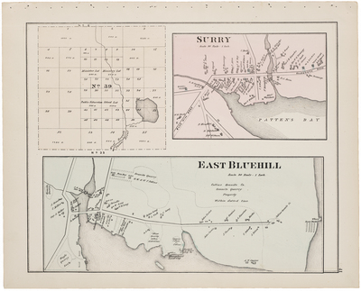
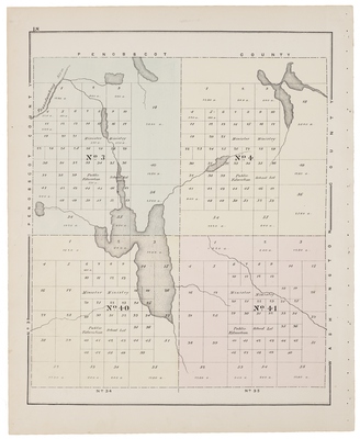
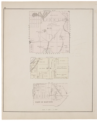
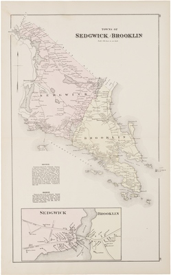
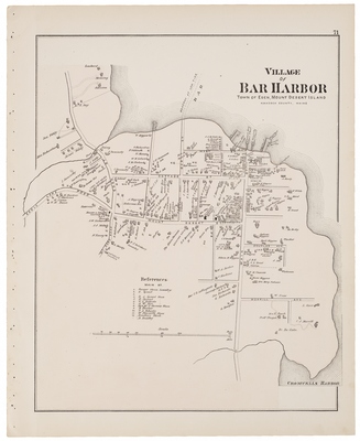
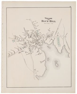
Atlas of Hancock County, Maine. Compiled and Published under direction of Geo. N. Colby, S.F. Colby & Co. Drawn from official Plans, U.S. Coast Survey Charts, and actual Surveys by H.E. Halfpenny and J.H. Stuart, Ellsworth, ME, 1881.
Printing is not supported at the primary Gallery Thumbnail page. Please first navigate to a specific Image before printing.

Follow

Switch View to List View Slideshow
 
  • Advertising information from East Maine Conference Seminary in Bucksport and Boston Clothing Store in Ellsworth

    Advertising information from East Maine Conference Seminary in Bucksport and Boston Clothing Store in Ellsworth

  • Amherst

    Amherst

  • Aurora

    Aurora

  • Bucksport Village

    Bucksport Village

  • Burnt Coat or Swan's Island, Town of Bucksport

    Burnt Coat or Swan's Island, Town of Bucksport

  • Castine, Brooksville

    Castine, Brooksville

  • Castine Village

    Castine Village

  • City of Ellsworth

    City of Ellsworth

  • City of Ellsworth Village plan No.1

    City of Ellsworth Village plan No.1

  • City of Ellsworth Village plan No. 2

    City of Ellsworth Village plan No. 2

  • City of Ellsworth Village plan No. 3 Ward 2 and Ward 5

    City of Ellsworth Village plan No. 3 Ward 2 and Ward 5

  • City of Ellsworth Village plan No. 4 Falls Village

    City of Ellsworth Village plan No. 4 Falls Village

  • Dedham, Otis,Hancock Cty. Atlas 1881-29069.jp

    Dedham, Otis,Hancock Cty. Atlas 1881-29069.jp

  • Deer Isle, Greens Landing, North West Harbor

    Deer Isle, Greens Landing, North West Harbor

  • East Surry Village

    East Surry Village

  • Isle Au Haut, Eastbrook, Franklin

    Isle Au Haut, Eastbrook, Franklin

  • Lamoine, Mariaville Township No. 21, Waltham

    Lamoine, Mariaville Township No. 21, Waltham

  • Map of Hancock County Maine

    Map of Hancock County Maine

  • Mount Desert and Adjacent Island embracing the towns of Eden, Mount Desert, Tremont and Cranberry Isles

    Mount Desert and Adjacent Island embracing the towns of Eden, Mount Desert, Tremont and Cranberry Isles

  • Orland Village and the towns of Orland and Verona

    Orland Village and the towns of Orland and Verona

  • Otis, Franklin, Township No. 10

    Otis, Franklin, Township No. 10

  • Patrons' Business References

    Patrons' Business References

  • Patrons' Business References

    Patrons' Business References

  • Patrons' Business References

    Patrons' Business References

  • Patrons' Business References

    Patrons' Business References

 
  • 1
  • 2


Search

Advanced Search

  • Notify me via email or RSS

Browse

  • State Agencies
  • Subjects
  • Contributors

For Agency Contributors

  • FAQs

Featured Links

  • Maine Government
  • Maine State Library
  • Maine State Agencies
  • Digital Maine Partners

Gallery Locations

  • View gallery on map
  • View gallery in Google Earth
 
Elsevier - Digital Commons

Home | About | FAQ | My Account | Accessibility Statement

Privacy Copyright