

Preview
Contributing Institution
Maine State Archives
Document Type
StillImage
Identifier
302962
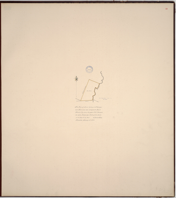
Description
Page 12 of the Knox County planbook. Copied from the Massachusetts Archives Maps and Plans #832. Notation on map "from House papers 1779, No. 426."
"This Plan of Land lying in St. Georges now Thomaston was surveyed for Mason Wheaton Esq. about the year 1772. Contains 200 acres. Drawn by a scale of 20 chains or 80 rods to an inch."
Exact Creation Date
1-13-1779
Language
English
Location
Knox County; Thomaston; Saint George
Keywords
Cartography; Maps; Maine Land Office; Planbooks; Surveys
Image Location
Rights Statement
No Copyright - United States. URI: http://rightsstatements.org/vocab/NoC-US/1.0/
The organization that has made the Item available believes that the Item is in the Public Domain under the laws of the United States, but a determination was not made as to its copyright status under the copyright laws of other countries. The Item may not be in the Public Domain under the laws of other countries. Please refer to the organization that has made the Item available for more information.