

Preview
Contributing Institution
Maine State Archives
Document Type
StillImage
Identifier
29424
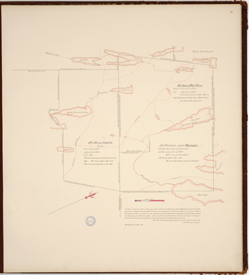
Description
Page 26 of the Kennebec County planbook Plan of Readfield, Mount Vernon, and Washington Plantation (now part of Mount Vernon). Scale of 200 to an inch.
Exact Creation Date
5-23-1795
Language
English
Location
Kennebec County; Readfield; Mount Vernon
Other Location
Wyman's Plantation; Long Pond; Whittiers Pond; Crotched Pond; Lanes Pond; Greeleys Pond; Chandlers Mill Pond; Flying Pond; Parkers Pond; Bishops Pond
Keywords
Cartography; Maps; Maine Land Office; Planbooks; Surveys